Track where you searched and build better field coverage
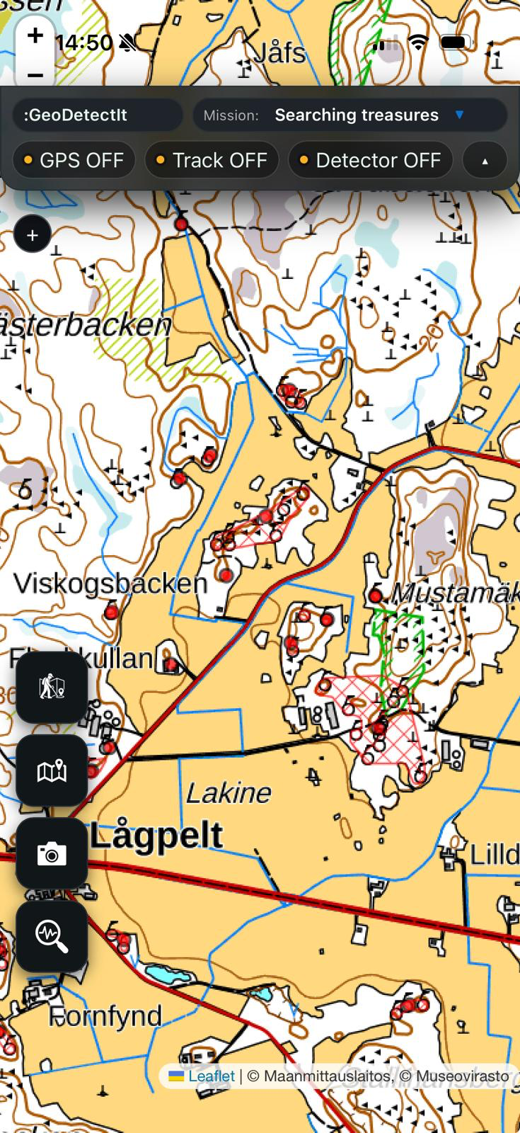
GeoDetectit works as a GPS tracker for metal detecting fieldwork. It helps you record where you walked, revisit gaps, reduce overlap and keep your routes connected to finds, photos and map context.
Why GPS tracking matters for detector fieldwork
Without route awareness, it is easy to rely too much on memory. On larger fields, repeated visits, wooded sites or complex terrain, that quickly leads to wasted effort.
- the same ground may get searched again without realising it
- gaps in coverage remain invisible
- productive areas become harder to compare between sessions
- later documentation loses route context
How GeoDetectit uses GPS tracking
GeoDetectit does more than show a dot on a map. It treats movement as part of a broader field workflow.
- tracks are tied to missions
- routes can be reviewed later with map layers
- photos and find notes stay closer to field context
- open export makes later analysis easier
Track your route
Record walking paths during a session and keep a more honest picture of where you actually searched.
See gaps more clearly
Routes and maps together make it easier to see where the next pass should happen.
Link tracking to documentation
GPS becomes more useful when it sits inside missions, finds, photos and exportable field data.
More than just a route recorder
A generic GPS tracker can show movement, but detector fieldwork often needs more than that. GeoDetectit is built around detector-specific field structure.
- missions per field or site
- map layers relevant to detector work
- photos and notes linked to the same workflow
- open export to standard formats
Useful for repeat visits
GPS tracking becomes especially valuable when you return to the same location over days, weeks or seasons. It helps you remember what was actually covered instead of relying on rough impressions.
Portable route data
GeoDetectit supports open export formats such as GPX, GeoJSON, KML and ZIP. That means your GPS route data can stay useful outside the app too, whether for GIS review, archive or future reporting.